


Title: Bacons Vintage London Metropolitan Police Courts Coloured Map. Description: Bacons Vintage London Metropolitan Police Courts Co...
Collectables Auctions
Explore an enormous array of collectables auctions on the UK's leading online auction marketplace. Browse models, toys, dolls, games, arms, armour, militaria, books & periodicals, sporting equipment & memorabilia, musical instruments, stamps, coins, classic cars & motorcycles, camera & camera equipment, wines & spirits, maps, religious items & folk art, banknotes, entertainment memorabilia, and more. With so many reputable auction houses selling on the saleroom, you can find the collectables auctions you're looking for and more. Use tools like watch lists, auction alerts, filters, and more to speed up your search and compete in live and timed auctions. Place winning bids on the items that match your criteria and get your next collectable on the saleroom.
Popular categories
Musical Instruments & Memorabilia
Bank Notes
Cameras & Photography Equipment
Entertainment Memorabilia
Kitchenalia
Toys & Games
Railwayana
Religious Items & Folk Art
Scientific Instruments
Writing Instruments
Sports Memorabilia & Equipment Auctions
Collectable Stamps
Tools
Taxidermy
Arms, Armour & Militaria
Vintage Wine & Spirits
Upcoming auctions
585 item(s)
Filtered by:
- Category
- List
- Grid
-
585 item(s)/page

Title: Collection 9 Rare Vintage George Bacon London & Suburbs Large Scale Maps Description: Collection 9 Rare Vintage George Bacon Lo...

Ortelius (Abraham) Indiae Orientalis Insularumque Adiacientium Typus, hand-coloured map of Southeast Asia, Japan, and the Philippines, etc., ...

London. Reynolds' Large Coloured Map of London and its Suburbs with visitors Guide, Street Directory Views etc. first an engraved folding map wit...

Lot 339
DEVON. Speed, John.
DEVON. Speed, John. Devonshire with Excester Described, an engraved county map, hand coloured, to be sold by Bassett & Chiswell (1676 edn.), in a ...

Naturgeschichte der Vogel Victorian German text volume numerous colour plates around 70 mostly double-page plates together with Systemacischer At...

Lot 509
17th century, English School, brown pen ink drawing. Depicting a five arch bridge over a river.
17th century, English School, brown pen ink drawing. Depicting a five arch bridge over a river. Information verso, image 12.5cm x 20cm, framed and...

A Coloured City Map Of Exeter Circa 1597
![[ATLAS] BELL, WilIam.](https://portal-images.azureedge.net/auctions-2024/bearne10150/images/5f19849a-3249-4645-8396-b15000fc8ac4.jpg?w=155&h=155)
Lot 325
[ATLAS] BELL, WilIam.
[ATLAS] BELL, WilIam. A New General Atlas … principal countries in ...
![[ATLAS] COLE and ROPER. Nightingale, Joseph.](https://portal-images.azureedge.net/auctions-2024/bearne10150/images/4bd431a9-b8cb-49bb-9b6a-b15000fc8b3f.jpg?w=155&h=155)
[ATLAS] COLE and ROPER. Nightingale, Joseph. English Topography: or, a series of … Counties of England and Wales. Accompanied by a Map of each Cou...

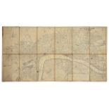
London. Fraser's Panoramic Plan of London, London, 1831, James Fraser, a steel engraved folding map dissected in fifteen sections and backed on ...

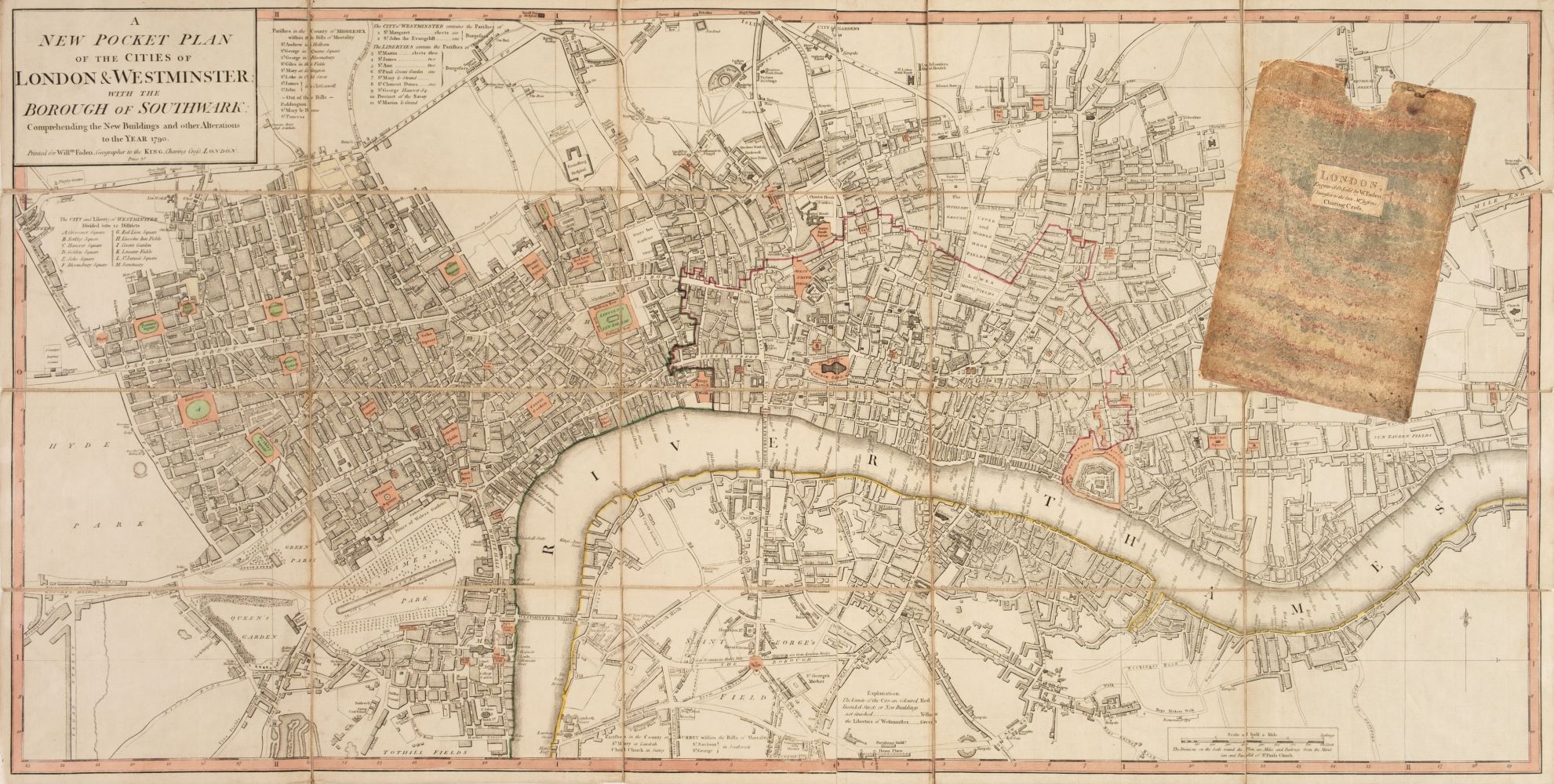
London. Bowles's Reduced New Pocket Plan of the Cities of London and Westminster, with the Borough of Southwark, exhibiting the New Buildings to 1...
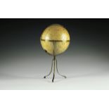
Seltener Mondglobus von Paul Räth. Leipzig, 1963, bezeichnet mit "Räths Mondglobus, Durchmesser 33 cm, Maßstab 1:10400000, Die Namen der Formatio...
Lot 250
MOUNTAINEERING.
MOUNTAINEERING. Whymper, Edward, Scrambles Amongst the Alps in the Years 1860-69, London: John Murray 1893, 4th edition, folding maps and plates, ...

Lot 363
SPEED, John.
SPEED, John. Devonshire with Excester Described, published by John Sudbury & George Humble 1623, hand coloured map, Exeter shown in an inset to on...
![[DEVON] BLAEU, Joan.](https://portal-images.azureedge.net/auctions-2024/bearne10150/images/9bf08fd8-a4c6-4b36-a926-b15000fc8d1a.jpg?w=155&h=155)
Lot 330
[DEVON] BLAEU, Joan.
[DEVON] BLAEU, Joan. Devonia vulgo Devon-Shire, hand coloured map, 1645 or later, latin text, f&g, 40cm x 52cm; together with MORDEN, Robert. Devo...
Lot 363A
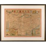
SPEED, John.
SPEED, John. Kent, with her Cities and Earles described and observed, hand coloured map with inset plans of Rochester and Canterbury, English text...
Thames. Ravenstein's Oarsmen's and Anglers Map of the River Thames from its source to London Bridge a concertina style folding map backed on line...

London. Mogg's Stranger's Guide Through London and entirely New Plan. .....' steel engraved dissected folding map with hand colouring in twelve s...

London. Wyld's New Map of London, 1877 London, James Wyld, 1876, an engraved dissected map in forty sections backed on linen with some colouring,...

London. Tallis's Illustrated Plan of London and Its Environs, in commemoration of the Great Exhibition of Industry of All Nations 1851 a steel en...

Lot 41
A good collection of Wade buildings to include Whimsey on Why, with paper maps / village layouts,
A good collection of Wade buildings to include Whimsey on Why, with paper maps / village layouts, new-old stock condition (Qty). Condition genera...

An original poster, most likely issued for the 1953 re-release (GWTW was not released at all in France until 1951) of 'Gone With The Wind' or 'Aut...

Lot 359
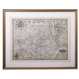
John Speed (1552-1629) Engraving Worcestershire Described, John Sudbury & George Humble (1627),
John Speed (1552-1629) Engraving Worcestershire Described, John Sudbury & George Humble (1627), hand-coloured engraved map, an inset town plan ...

Lot 361
Johannes Blaeu (1599-1673), Bercheria vernacule Barkshire, hand-coloured engraved map, circa 1645,
Johannes Blaeu (1599-1673) , Bercheria vernacule Barkshire, hand-coloured engraved map, circa 1645, framed and glazed, 49cm x 56.5cm

Taschen - Joan Blaeu Atlas Maior of 1665 hardback books with sleeve. Two reprinted collections of maps by Joan Blaeu comprising of Anglia, Scotia ...
DURHAM, The Bishoprieke and Citie of Durham. Hand coloured map, by John Speed, attractively f&g, circa 1610, with English text in the verso, 37.5c...
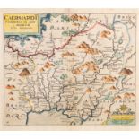
SAXTON, Christopher and William Kip. Caermardi Comitatus in quo Dimetae olim habitarunt (Carmarthenshire), 17th century engraved map with hand-col...

Lot 338
DEVON. GREENWOOD, C. & J.
DEVON. GREENWOOD, C. & J. Map of the County of Devon from an actual Survey made in the Years 1825 and 1826..., July 4th 1829, hand coloured engrav...

Lot 357
SAXTON, Christopher (Kip).
SAXTON, Christopher (Kip). Radnor Comitatue Quem Silvres, hand coloured engraved map, 1579-1600, 27cm x 32cm

Lot 353
MORDEN, Robert.
MORDEN, Robert. Devonshire, hand coloured engraved map, 1685 or later, browned, 36cm x 41cm

Lot 67
Uk maps: Speed (John)
UK maps Speed (John) Hartfordshire Described, first edition, hand-coloured engraving, after Jodocus Hondius, from The Theatre of Empire of Gr...

London. Lewis, (Samuel) A plan of London and its Environs shewing the Boundaries, shewing the Boundaries of the Cities of London and Westminster, ...
London. A New and Correct Plan of London, Westminster and Southwark, with several additional Improvements, not in any former Survey an engraved d...

London. Cruchley's New Plan of London improved to 1830 an engraved dissected map in thirty six sections, backed on linen and with hand colouring,...

Lot 6
Robert Morden – ‘Cornwall’ (Map of the County of Cornwall), 18th century copper engraving with
Robert Morden – ‘Cornwall’ (Map of the County of Cornwall), 18th century copper engraving with hand-colouring on laid paper, 35cm x 42cm, within a...

An assortment of various etched maps, to include Daniel Paterson Direct Roads, c1785, Thomas Badeslade Map of Hampshire, c1741, Van Den Keere - So...
![[BIBLE, Dutch. Biblia neerlandica]. Biblia, dat is De gantsche H.](https://portal-images.azureedge.net/auctions-2024/bearne10150/images/b9913667-9d4f-4fdb-aa34-b15000fb28d3.jpg?w=155&h=155)
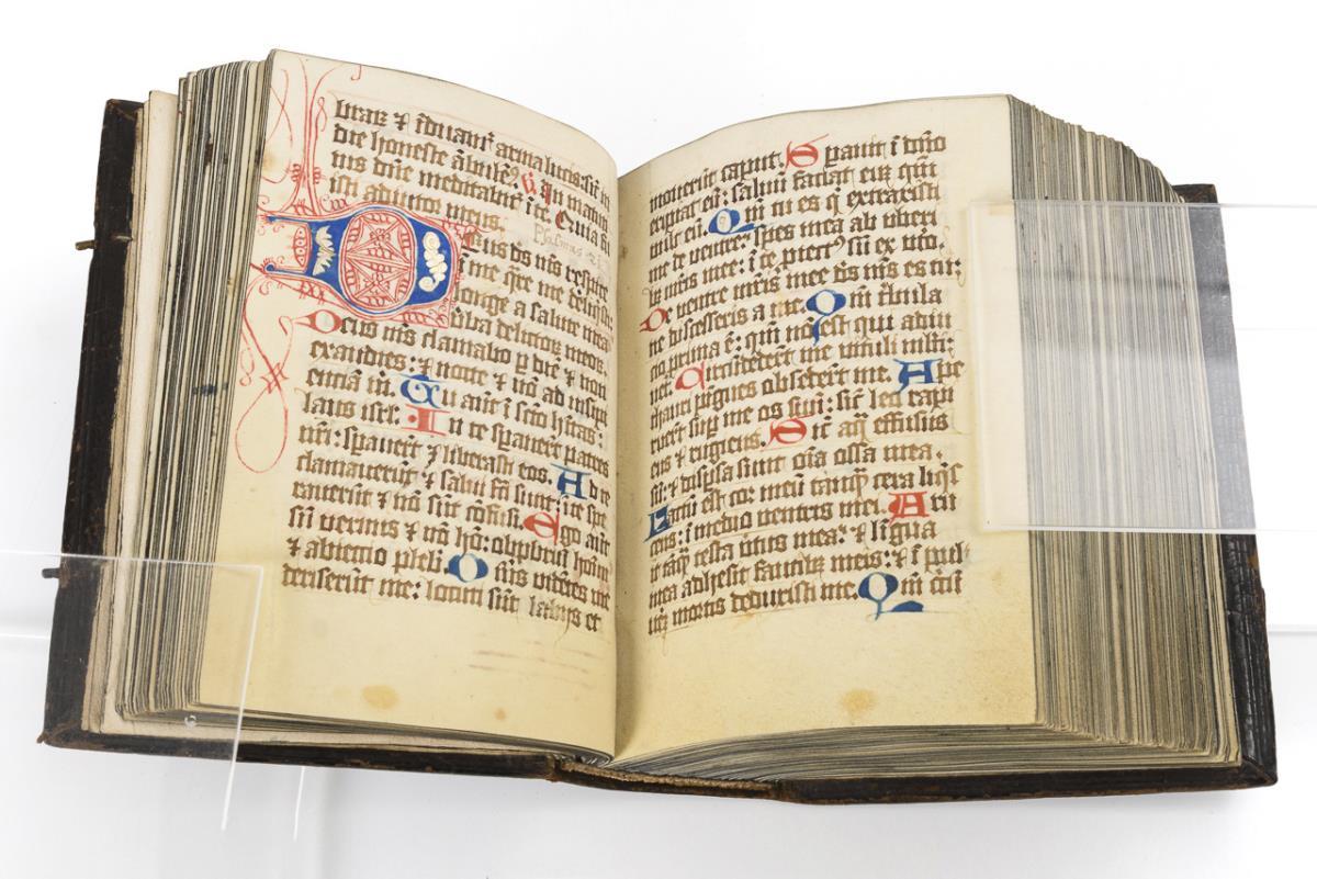
[BIBLE, Dutch. Biblia neerlandica]. Biblia, dat is De gantsche H. Schrifture, vervattende alle de Canonijcke Boecken des Ouden en des Nieuwen Test...

Lot 349
HERTFORDSHIRE.
HERTFORDSHIRE. Speed, John, Hartford Shire Described, a hand coloured engraved county map, Sudbury & Humbe (1611 edn. or later), foxed overall, 38...

Lot 337
DEVON. GREENWOOD, C. & J.
DEVON. GREENWOOD, C. & J. Map of the County of Devon from an actual Survey made in the Years 1825 and 1826..., July 4th 1829, hand coloured engrav...

Lot 65
Stow (John) A collection of 16 ward maps from ‘A Survey of the Cities of London and Westminster’
Stow (John) A collection of 16 ward maps from ‘A Survey of the Cities of London and Westminster’, including: ‘Spittle Fields and places adja...

Bacon's New Ordnance Survey Atlas of London and Suburbs, in eighteen double sheets, on the scale of nine inches to a mile…, 28 double page s...

British maps: Herman Moll, The North Part of Great Britain called Scotland, flanked by a chart of the Orkneys & Shetlands and eleven vi...

Wallis’s Complete Voyage Round the World, a new Geographical Pastime, engraved map of the world hand coloured, with instructions how...

Lot 63
Oxford: Williams (William) Nova & Accuratissima celeberrimae Universitatis Civitatisque Oxoniensis
63Oxford: Williams (William) Nova & Accuratissima celeberrimae Universitatis Civitatisque Oxoniensis
Oxford Williams (William) Nova & Accuratissima celeberrimae Universitatis Civitatisque Oxoniensis Ichnographia MDCCXXXIII, uncoloured city pl...

Seutter (Matthäus) Londinum celeberrima Metropolis, plan of London with large panorama, title panel in Latin and German, royal arms upper le...

London. Mogg (Edward) An Entire New Plan of the Cities of London & Westminster with the Borough of Southwark, Comprehending the New Buildings and ...
Lot 7
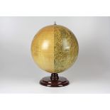
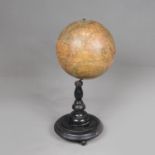
Table Globe
Table Globe, paper printed and described in German on original ebonized stand around 1900. 40 cm high.

After Michael Drayton (British, 1563-1631) - An etching on paper and hand coloured map of Glocestershyre (sic - Gloucestershire), from the poetic ...
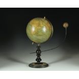
Seltenes Lunarium von Ernst Schotte. Berlin, um 1877, der Globus bezeichnet "Die Erdkugel nach den neuesten u. besten Quellen bearbeitet, Berlin ...
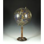
Schöner Himmelsglobus mit figürlichen Sternbildern. Deutschland, um 1915, nicht bezeichnet, der Globus als Pappmaché-Kugel mit 12 farblithographi...
Lot 691
Himmelsglobus von Carl Rohrbach
Himmelsglobus von Carl Rohrbach. Berlin, um 1896, bezeichnet "Himmelsglobus von Dr. Carl Rohrbach, D. Reimer Berlin (Hoefer&Vohsen)", der Globus ...

Two antique maps of Somerset Shire and Dorset- largest 19cm x 25.5cm

A hand coloured impression of John Speed's highly map of the county of Essex. Featured in the lower right corner is a detailed plan of Colchester,...

Mary STORK (1938-2007) Female in Repose Pastel on paper Information to the verso states it was previously sold in the estate sale of Rose Hil...

A 17th Century Framed Double Sided Map Of Cardiganshire

A carton of assorted Ordnance Survey Maps mainly UK.

Lot 359
SEALE, Richard William.
SEALE, Richard William. A Correct Chart of the English Channel, circa 1745, hand coloured engraved chart, four inset vignette charts, decorative t...

Lot 332
AFRICA. ELWE, Jan Barend.
AFRICA. ELWE, Jan Barend. L'Afrique Devisée en ses Empires, Royaumes et Etats, hand coloured engraved map, Amsterdam 1792, some foxing, 47.5cm x 6...

Lot 405
A collection of mezzotone lantern plates with topographical views of Halifax, most annotated, five
A collection of mezzotone lantern plates with topographical views of Halifax, most annotated, five boxes and some loose (1 box)