Filtered by:
- Sale Section
- List
- Grid
This auctioneer has chosen to not publish their results. Please contact them directly for any enquiries.
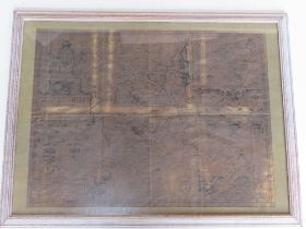

Map of Bedfordshire by John Speed, having Arms of the Honourable Families upon, folds noted, mounted and in contemporary frame, sight size approx ...
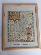
Map of Derbyshire (Darbieshire) by John Speed, having Arms of the Honourable Families upon, folds noted, loosely set in contemporary frame, sight ...
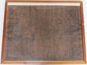
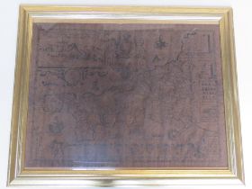
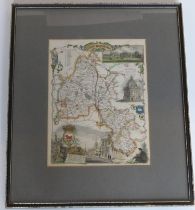
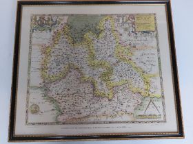
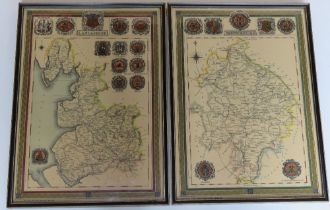
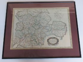
Map of Northamptonshire by John Speed, having Arms of the Honourable Families upon, folds noted,
Map of Northamptonshire by John Speed, having Arms of the Honourable Families upon, folds noted, mounted and in contemporary frame, sight size app...
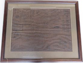
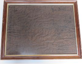
Map of Bedfordshire, having Arms of the Honourable Families upon, bottom edge lost, folds noted,
Map of Bedfordshire, having Arms of the Honourable Families upon, bottom edge lost, folds noted, loosely set and in contemporary frame, sight size...
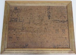
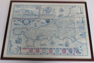
Map of Cornwall by John Speed, having vignettes and Arms of the Honourable Families upon, loosely mounted and in contemporary frame, sight size ap...
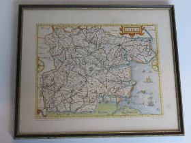
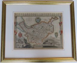
Map of Essex by John Norden....John Speed, having Arms of the Honourable Families upon, contemporary frame, sight size approx 45 x 34.5m, overall...
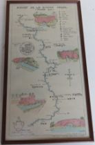
A strip map of Ashby De La Zouch canal, printed from a pen and ink by J Little, framed and glazed measuring approx 44.5 x 24cm overall.
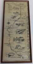
A strip map of Stratford on Avon canal published by the National Trust, framed and glazed, overall size 51.5 x 21.5cm.
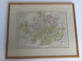
Printed map 'The Counties of Inverness, Ross and Cromarty' by Hughes, framed and glazed, sight size approx 31 x 24cm overall approx 45.5 x 38.5cm.
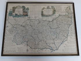
Print; 'The Doncella Map Series Yorkshire' from an original map by Eman Bowen in Hogarth style frame, overall size approx 57.5 x 45cm.
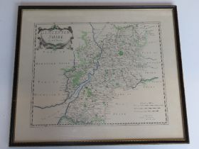
Print; 'The Doncella Map Series Suffolk' from an original map by Eman Bowen in Hogarth style frame,
Print; 'The Doncella Map Series Suffolk' from an original map by Eman Bowen in Hogarth style frame, overall size approx 57 x 45cm.
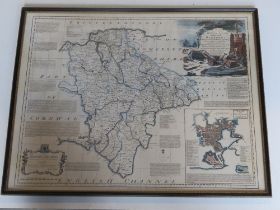
Print; 'The Doncella Map Series Devon Shire' from an original map by Eman Bowen in Hogarth style frame, overall size approx 57 x 45cm.
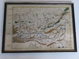
Print; map of Eastern Europe in Latin inc Transylvania, Austria, Germania, etc, in Hogarth style frame, overall size approx 45 x 32cm.
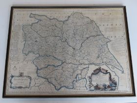
Print; Map of Gloucestershire by Robert Morden, sight size approx 36.5 x 29.5cm in Hogarth style frame, 46.5 x 40cm overall.
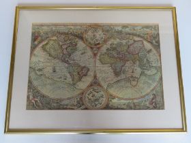
Print; World Map 'Orbis Terrae Compendiosa Descriptio' mounted and within contemporary frame,
Print; World Map 'Orbis Terrae Compendiosa Descriptio' mounted and within contemporary frame, sight size approx 51 x 35cm, overall approx 66.5 x 5...
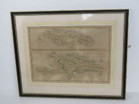
Map; Hayti and Jamaica engraved by Edward Weller, handcoloured, for weekly Dispatch Atlas measuring approx 44 x 32cm mounted in Hogarth style fram...
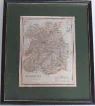
Map of Shropshire drawn and engraved by J Archer for Dugdales England and Wales, steel engraving c1845, hand coloured, sight size 17.5 x 23cm, mou...
Map of Oxfordshire, hand coloured engraving with vignettes inc Blenheim House and Radcliffe LIbrary,
Map of Oxfordshire, hand coloured engraving with vignettes inc Blenheim House and Radcliffe LIbrary, sight size approx 19 x 25.5cm, mounted and in...
A copper etching from John Speed's Northamptonshire map approx 40 x 32cm overall, together with a stainless steel map from Robert Morden Buckingha...
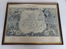
Print; 'The Armada' showing places of action between the English and Spanish fleets, from the John Pine map, framed and glazed, overall size appro...
Print; John Speed's map of Cornwall, published 1997 by Heritage, framed and glazed and measuring approx 57 x 45cm overall.
Print; Norden's map of Northamptonshire, framed and glazed, overall approx 35 x 45cm
Print; John Norden's map of Essex printed by the Essex Record Office, sight size approx 29.5 x 22.
Print; John Norden's map of Essex printed by the Essex Record Office, sight size approx 29.5 x 22.5cm, framed and glazed within Hogarth style fram...
Print of Saxton's Map of Oxfordshire, Buckinghamshire and Berkshire, printed by Taylowe 1962 in Hogarth style frame, measuring approx 55.5 x 50cm ...
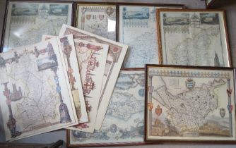
Prints of Lancashire and Warwickshire engraved for Lewis' topographical dictionary, each within matching Hogarth style frames, each measuring appr...
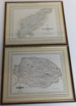
Prints; Northamptonshire and Norfolk from engravings by J Cary, in matching mounts and frames,
Prints; Northamptonshire and Norfolk from engravings by J Cary, in matching mounts and frames, each measuring approx 26 x 21cm sight size, each ap...
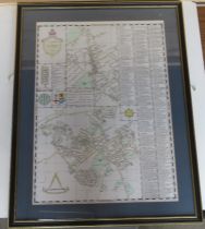
A pair of Ordnance Survey maps being Surrey/Essex in matching frames, mounted, each sight size approx 39.5 x 25cm, each overall size approx 60 x 4...
Map of Cheshire attributed to Thomas Houle (1784-1857) English Counties delineated 1837, hand coloured steel engraving with vignettes of Chester C...
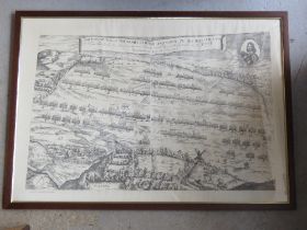
Print; 'The description of the Armies of Horse and Foot of His Majesties....At Nasbye', reduced from Robert Streater's original engraving, framed,...
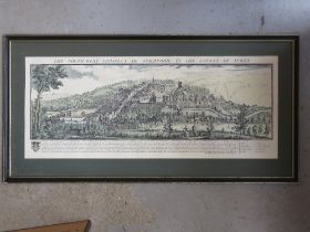
Print; 'The Southwest Prospect of Guildford in the County of Surrey' in Hogarth style frame,
Print; 'The Southwest Prospect of Guildford in the County of Surrey' in Hogarth style frame, mounted, glazing deficient, overall size approx 94.5 ...
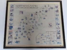
A print of 'The Pettit' memorial map of Northamptonshire and the Soke of Peterborough in Hogarth
A print of 'The Pettit' memorial map of Northamptonshire and the Soke of Peterborough in Hogarth style frame, overall size approx 59 x 51cm.
A contemporary map of Rushden in the County of Northamptonshire, mounted and within Hogarth style frame, sight size approx 41 x 58cm, overall appr...
Print; 'Make Germanicum' featuring English Shires, framed and mounted, sight size approx 48 x 35.
Print; 'Make Germanicum' featuring English Shires, framed and mounted, sight size approx 48 x 35.5cm, overall approx 61 x 50cm.
A hand painted map of Egypt on papyrus together with a quantity of other cartographic prints.
A hand painted map of Egypt on papyrus together with a quantity of other cartographic prints. Seven items.
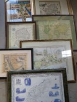
A quantity of late 20thC cartographic prints inc maps of Sussex, Northamptonshire, Cheshire,
A quantity of late 20thC cartographic prints inc maps of Sussex, Northamptonshire, Cheshire, Cambridgeshire, Buckinghamshire, etc. Six framed, sev...