Filtered by:
- Category
- List
- Grid
This auctioneer has chosen to not publish their results. Please contact them directly for any enquiries.

Map: An 18thC engraved and hand coloured map of Buckinghamshire after Robert Morden. Approx. 8 1/
Map: An 18thC engraved and hand coloured map of Buckinghamshire after Robert Morden. Approx. 8 1/4" x 6 1/4"Please Note - we do not make reference...
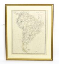
Map: A 19thC engraved and hand coloured map of South America. Published by the Society for the
Map: A 19thC engraved and hand coloured map of South America. Published by the Society for the Diffusion of Useful Knowledge. Approx. 15 3/4" x 12...
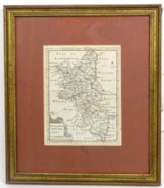
Map: An 18thC engraved and hand coloured map of Northamptonshire, with description of Northamptonshire under, mounted together. Map approx. 8 1/2"...
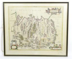
Map: A 17thC engraved and hand coloured map of Scotland titled Strath-Navernia / Strath Navern after
Map: A 17thC engraved and hand coloured map of Scotland titled Strath-Navernia / Strath Navern after Blaeu. Signed in pencil lower. Approx. 17" x ...
Map: A 19thC engraved map titled Gloucestershire from the Best Authorities, after John Cary. Approx.
Map: A 19thC engraved map titled Gloucestershire from the Best Authorities, after John Cary. Approx. 19" x 16 1/2"Please Note - we do not make ref...
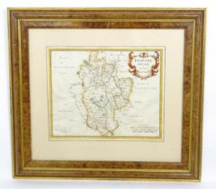
Map: A 17thC engraved and hand coloured map of Bedfordshire after Robert Morden. Approx. 12 1/2" x
Map: A 17thC engraved and hand coloured map of Bedfordshire after Robert Morden. Approx. 12 1/2" x 15 1/4"Please Note - we do not make reference t...
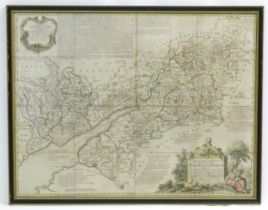
Map: An 18thC map of Gloucestershire with hand colouring, titled An Accurate Map of the Counties
Map: An 18thC map of Gloucestershire with hand colouring, titled An Accurate Map of the Counties of Gloucester and Monmouth Divided into their Res...
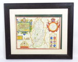
Map: An engraved and hand coloured map titled The Countie of Nottingham described The Shire Townes
Map: An engraved and hand coloured map titled The Countie of Nottingham described The Shire Townes Situation and the Earls Ther Of observed, after...
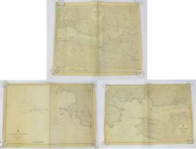
Three mid 20thC Hydrographic Office maritime navigational charts for Wales - South Coast, comprising
Three mid 20thC Hydrographic Office maritime navigational charts for Wales - South Coast, comprising 1478 St Gowan's Head to St David's Head, 3274...
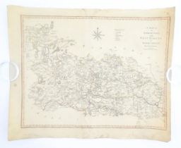
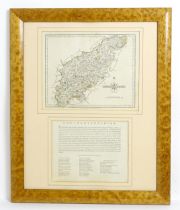
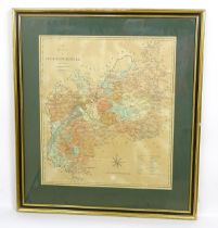
Map: A 19thC engraved map of West Riding, titled A Map of the North Part of the West Riding of
Map: A 19thC engraved map of West Riding, titled A Map of the North Part of the West Riding of Yorkshire after John Cary. Approx. 16 1/4" x 21 1/4...
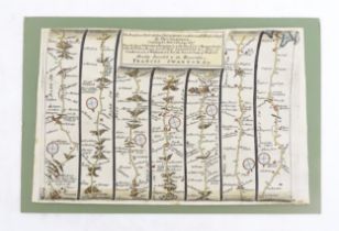
Map: An 18thC engraved strip map with hand colouring titled The Road from Oxford to Salisbury by
Map: An 18thC engraved strip map with hand colouring titled The Road from Oxford to Salisbury by Thomas Gardner. Approx. 7 1/4" x 10 3/4"Please No...
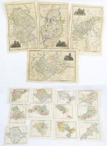
Maps: A quantity of assorted engraved and hand coloured maps to include Northamptonshire, Nottinghamshire, Lincolnshire, Leicestershire & Rutlands...
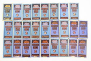
A quantity of assorted 20thC Bartholomew road maps to include Cambridge, Dorset, New Forest, Sussex,
A quantity of assorted 20thC Bartholomew road maps to include Cambridge, Dorset, New Forest, Sussex, Warwickshire, Merseyside, Norfolk, English La...
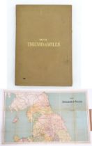
Maps: A 20thC Map of England and Wales on two folding cloth sheets North Sheet and South Sheet, with
Maps: A 20thC Map of England and Wales on two folding cloth sheets North Sheet and South Sheet, with Index Guide to Map. Published by The Chart Pu...
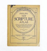
Maps: Philips' New Scripture Atlas, to include maps and plans illustrating the historical geography of Palestine and the Lands of the Bible, by Ge...