Filtered by:
- Category
5 items
- List
- Grid
A subscription to the Price Guide is required to view results for auctions ten days or older. Click here for more information
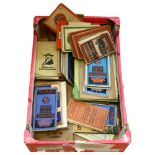

Lot 360
A quantity of Vintage Bartholomew, Ordnance Survey, maps, Ward & Locks Pictorial Guides, and various
A quantity of Vintage Bartholomew, Ordnance Survey, maps, Ward & Locks Pictorial Guides, and various other maps and travel literature
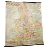
Lot 657
Scarborough's map of England and Wales, showing geographical counties and boroughs, 108cm x 90cm
Scarborough's map of England and Wales, showing geographical counties and boroughs, 108cm x 90cm overall
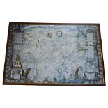
An Antique style map of Isleworth, Middlesex, framed, 65cm x 100cm
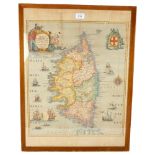
An Antique map of Corsica, framed, 63cm x 48cm
Lot 732
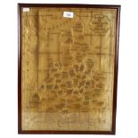
A Victorian silk framed map of England and Wales, 53cm x 40cm There is some fraying to bottom of the
A Victorian silk framed map of England and Wales, 53cm x 40cmThere is some fraying to bottom of the map and several splits in the silk over the re...