
Filtered by:
- Sale Section
- List
- Grid
A subscription to the Price Guide is required to view results for auctions ten days or older. Click here for more information
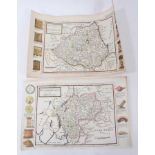

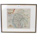
Herman Moll - hand coloured early 18th engraved map of Westmorland together with another of Durham
Herman Moll - hand coloured early 18th engraved map of Westmorland together with another of Durham, 21 x 33cm ...[more]
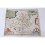
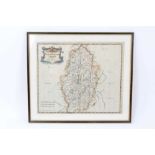
John Speede (after Saxton) - Montgomerieshire, hand coloured engraving, 1610 first edition, English descriptive text verso, 39 x 48cm ...[more]
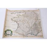
Nicholas Sanson - La Gaule en quartre Regions - France in Roman Times, hand coloured engraving, 41 x 51cm ...[more]
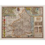
John Speede - Northumberland, hand coloured engraved map, 1662 reissue, 38 x 51cm, glazed frameGlazed frame, not examined out of frame and mounted...
William Kip after Christopher Saxton (1540-1610), coloured engraving, Map of Cumbria, 1637, plate 28 x 32cm, glazed frame ...[more]
William Kip after Christopher Saxton (1540-1610), 17th century coloured engraving, Map of Huntington
William Kip after Christopher Saxton (1540-1610), 17th century coloured engraving, Map of Huntington, plate 27 x 33cm ...[more]
William Kip after Christopher Saxton (1540-1610), 17th century coloured engraving: Map of Denbigh
William Kip after Christopher Saxton (1540-1610), 17th century coloured engraving: Map of Denbigh, plate 26 x 32cm, glazed frame ...[more]
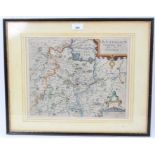
Robert Morden, handcoloured engraved map of Nottinghamshire, together with four others of the region
Robert Morden, early 18th century handcoloured engraved map of Nottinghamshire, 36 x 42cm, glazed frame, together with large Emanuel Bowen map of ...
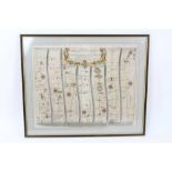
John Ogilby: pair of hand coloured engraved road maps: London to Flambrugh Head, 1698, plate 32 x 44cm, and The Continuation of the Road from Lon...
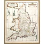
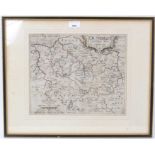
Robert Morden hand coloured engraved map - 'Brittania Saxonica', 1695, plate 39 x 31cm, glazed frame ...[more]
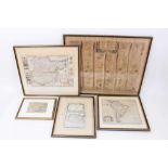
Group of 17th / 18th / 19th century maps, including John Ogilby, The Continuation of The Road from Chester to Cardiff, Herman Moll map of Essex, s...
Robert de Vaugondy family and Nicholas Sanson, 1750, Britannicae Insulae, map of British Isles.
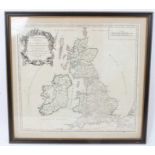
Robert de Vaugondy family and Nicholas Sanson, 1750, Britannicae Insulae, engraved map of British Isles, with hand colouring, 49 x 53cm, glazed fr...