


Lot 337
Speed, John
Speed, John The Invasions of England and Ireland with al [sic] their Civill Wars since the Conquest Performed by John Speed and are to be solde ...
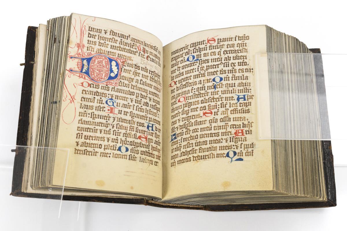
Explore an enormous array of collectables auctions on the UK's leading online auction marketplace. Browse models, toys, dolls, games, arms, armour, militaria, books & periodicals, sporting equipment & memorabilia, musical instruments, stamps, coins, classic cars & motorcycles, camera & camera equipment, wines & spirits, maps, religious items & folk art, banknotes, entertainment memorabilia, and more. With so many reputable auction houses selling on the saleroom, you can find the collectables auctions you're looking for and more. Use tools like watch lists, auction alerts, filters, and more to speed up your search and compete in live and timed auctions. Place winning bids on the items that match your criteria and get your next collectable on the saleroom.
Speed, John The Invasions of England and Ireland with al [sic] their Civill Wars since the Conquest Performed by John Speed and are to be solde ...
Map of 'Merionethshire' by John Speed , circa 1610, 43cm x 52cm, unframed and a map of 'The Fennes' by Ioannis Ianbonii, circa 1650, 44cm x 56cm...
Cary, John "Cary's Traveller's Companion or a Delineation of the Turnpike Roads of England and Wales....." London Printed for John Cary Map and P...
JOHN SPEED, AN 18TH CENTURY HAND COLOURED MAP OF NORTHAMPTONSHIRE With text to reverse chapter 28 book 1, together with a receipt from Boydell Gal...
Maps of the Canary Islands comprising : "The Canarie Islands" by Robert Morden, "Les Isles Canaries" by Robert de Vangondy, "Isle Canaries" by Pie...
DURHAM, The Bishoprieke and Citie of Durham. Hand coloured map, by John Speed, attractively f&g, circa 1610, with English text in the verso, 37.5c...
Maps of Durham and Lancaster , by John Speed, comprising: "The Countie Pallatine of Lancaster", and "Episcopatvs Dvnelmensis Vulgo The Bishoprike ...
A strip map of Northumberland: "The Road from Tinmouth in Northumberland to the City of Carlisle in Cumberland", by John Ogilby, hand tinted, in ...
Two maps by Robert Morden comprising: "Northumberland", hand tinted, in frame; and "Westmorland", hand tinted, in frame. (2)
ETHIOPIA ORTELIUS (ABRAHAM) Presbiteri Iohannis, sive, Abissinorum Imperii Descriptio, hand-coloured engraved double-page map, large cartouche w...
Robert Morden, hand coloured map of East Riding of Yorkshire
Robert Morden, antique hand coloured map of Surrey, together with another of Devonshire
Map by Robert Morden , Hampshire, handcoloured, 36cm x 43cm, a strip map by John Ogilby 'Hereford to Leicester', circa 1675, 34cm x 45cm, unfram...
Map of Herefordshire by Robert Morden , handcoloured, 36cm x 41cm, 'Barkshire' by Robert Morden handcoloured map, 37cm x 44cm and Rutland 'Rout...
Maps of Northumberland including : "Northumberland" by Robert Morden, "Northumberland" by J & C Walker, "Northvmbrlae" by Christopher Saxton, and ...
A collection of maps of Durham , including: "Dvnelmensis" by Christopher Saxton, "The County Palatine of Durham" by H. Moll, "Episcopatus Dunelmen...
Maps of Northumberland and Durham , comprising: "Northumberland" by Robert Morden, and a "A Map of Durham", by J. Cary, hand-tinted, in frames. (2)
Map of Shropshire : "Shropshire", by Robert Morden, hand-tinted, in frame.
CARY JOHN. Cary's New & Correct English Atlas Being a New Set of County Maps from Actual Surveys Exhibiting all the Direct & Principal Cross Road...
ROBERT MORDEN MAPS (a pair) - 18th century hand coloured engraved maps of Kent and Lincolnshire, 35 x 63cms, and 38 x 43cms (2) Provenance: pri...
Robert Morden, hand coloured map of Scotland
Robert Morden, a hand coloured map 'The West Riding of Yorkshire, F & G 36 x 42cm.
After Robert Morden, hand coloured map North Wales, 36 x 43.5cm F & G
Ortelius, Abraham: Portugalliae quae olim Lusitania, novissima & exactissima descriptio. Antwerp, c.1574. Hand-coloured, mounted, framed and g...
CHRISTOPHER SAXTON (c.1540-c.1610) AND WILLIAM KIP (fl. 1585-1618), Lecestriae, hand tinted engraved map of Leicestershyre, double page, with cart...
ROBERT MORDEN (1650-1703) A map of the West Riding of Yorkshire hand-coloured engraving, 35cm x 40cm
Title: Dorset Coast Weymouth Portland John Cary's Antique 230 Yrs Old Map-5. Description: Dorset Coast Weymouth Portland John Cary's A...
Title: East Anglia Norfolk Suffolk John Cary's Antique 230 Yrs Old Map-35. Description: East Anglia Norfolk Suffolk John Cary's Antiqu...
Title: Isle Of Wright St Lawrence Niton Chale John Cary's Antique 230 Yrs Old Map. Description: Isle Of Wright St Lawrence Niton Chale...
Title: Newcastle Gateshead Chester Le Street Antique King George III 1794 Map. Description: Newcastle Gateshead Chester Le Street Anti...
After Robert Morden (1650-1703, British cartographer), antiquarian map, 'Northamptonshire', framed and under glass, measuring 38cm x 42cm, & 42cm ...
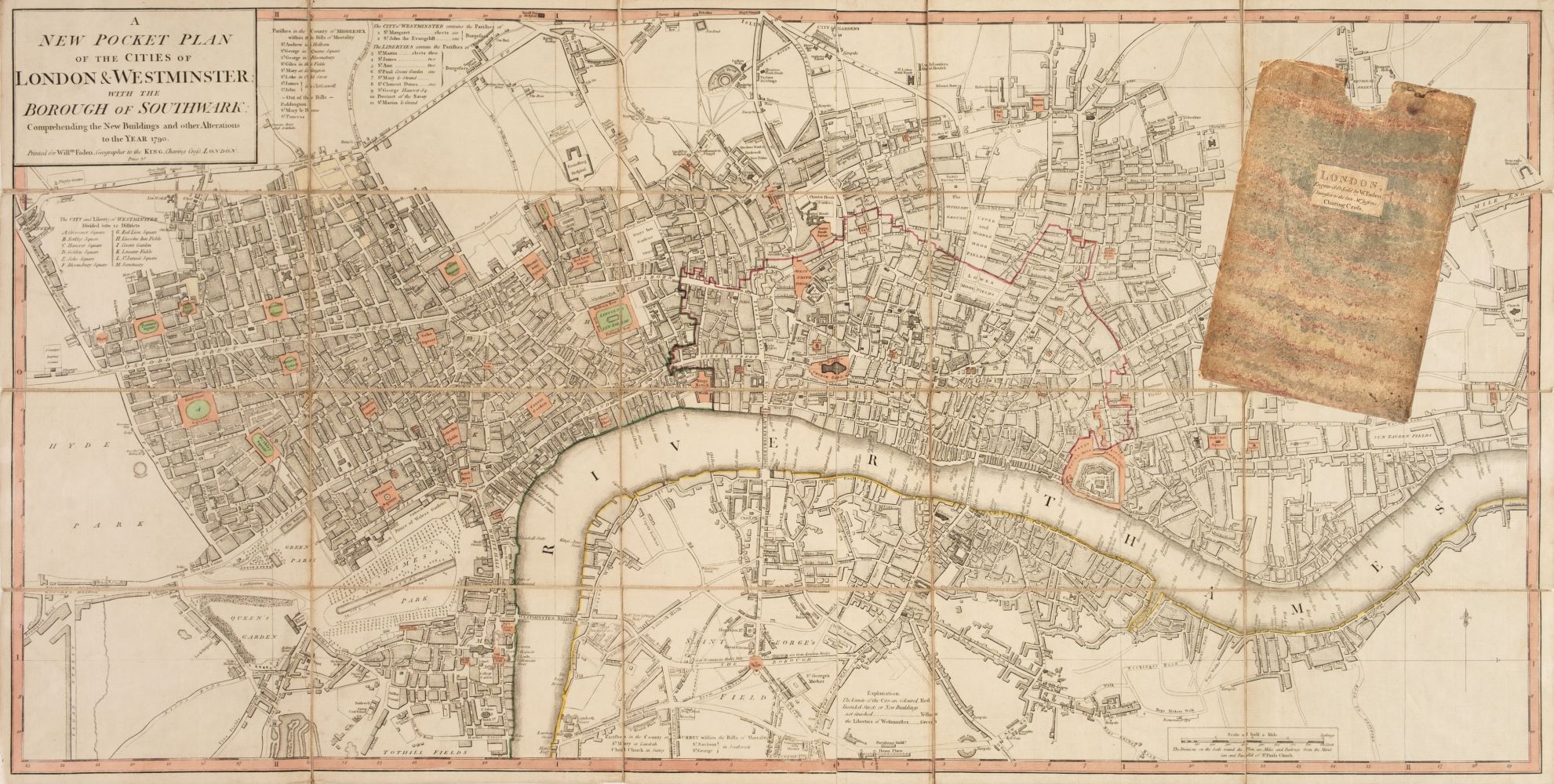
William Darton (1755-1819), folding hand coloured map, New and Correct Plan of London and Westminster with the Latest Improvements, publ. 1814, Wi...
Robert Morden, Leicestershire, map, 37x43cm.
Two maps of Yorkshire & Kent. Yorkshire by John Cary, dated 1809, hand coloured, 28cm x 23cm, retailed by Harrods Collectors Treasures; Kent by J....
Robert Morden, a map of Kent, Circa 1700, hand coloured, 14.5" x 25.5" (37 x 65cm), along with 'Tunbridge Wells humbly Dedicated to Thomas Pellet...
John Speed, a 17th Century map hand coloured map, 'Leicester both county and citie described, the honourable families that have the titles of Earl...
After Robert Morden. A framed map of Cornwall, later coloured, 37cm x 41cm, framed and glazed.
Four unframed 17th century maps of Sussex; two by Robert Morden, 39 x 43cm and 37 x 43cm, Norden & Kip 28 x 42cm, and Valk & Schenk, 49 x 59cm *...
Three unframed 17th century maps of Sussex; a Norden and Kip map, 25 x 41cm, a John Speed, 41 x 54cm and a John Overton, 37 x 54cm ***CONDITION ...
Three unframed 17th century maps of Sussex; Richard Blome, 31 x 35cm, Robert Morden, 38 x 44cm and Johannes Blaeu, 42 x 56cm ***CONDITION REPORT...
Three unframed 17th century maps of Sussex; Jan Jansson, 40 x 53cm, Robert Morden, 37 x 43cm and Norden & Kip, 29 x 45cm ***CONDITION REPORT*** ...
John Speed (1552-1629), mid 17th century hand coloured map of Hartfordshire, 39 x 52cm, text verso, sold by Thomas Bassett and Richard Chiswell ...
Pieter van den Keere for John Speed, three hand coloured engraved miniature maps from Speed’s Epitome; to include; Tartaria, China & The Turkish E...
Warwickshire, three antique framed maps of Warwickshire, including; Bowen & Owen Warwickshire, Warwickshire by Christopher Saxton from Camden’s Br...
Title: South Devon Torbay Brixham Paignton John Cary’s Antique 1794 Map-3. Description: South Devon Torbay Brixham Paignton John Cary’...
Title: Lundy Island Camelford Launceston Cornwall & Devon Antique 230 Yrs Old Map. Description: Lundy Island Camelford Launceston Joh...
Title: Dover Straits Channel Ports Calais John Cary's Antique 230 Yrs Old Map. Description: Dover Straits Channel Ports Calais John Ca...
Title: Lincolnshire Lincoln, Grantham, Boston John Cary's Antique 230 Yrs Old Map. Description: Lincolnshire Lincoln, Grantham, Boston...
Title: Isle of Man South Douglas Peeltown John Cary’s Antique 1794 Map-56. Description: Isle of Man South Douglas Peeltown John Cary’s...
Title: Isle of Man South Douglas, Port Erin John Cary’s King George III 1794 Map-47. Description: Isle of Man South Douglas, Port Erin...
Title: Scarborough, Filey, Cayton, Robin Hoods Bay Antique King George III 1794 Map-61. Description: Scarborough, Filey, Cayton, Robin...
Title: Lake District Kendal Cumbria John Cary's Antique King George III 1794 Map-58. Description: Lake District Kendal Cumbria John Ca...
Title: Cumbria & The Scottish Coast John Cary’s Antique Rare George III 230 Yrs Old Map. Description: Cumbria & The Scottish Coast Joh...
Title: Northumberland John Cary’s Antique Rare George III 230 Yrs Old Map. Description: Northumberland John Cary’s Antique Rare George...
Title: Blyth Tynemouth Shields Newbiggin John Cary’s 230 Yrs Old Antique Map. Description: Blyth Tynemouth Shields Newbiggin John Car...
Title: Ireland Dublin, Wicklow, Arklow, John Cary’s Antique 230 Yrs Old Map. Description: Ireland Dublin, Wicklow, Arklow, John Cary’s...
Title: Newry, Carlingford Drogheda John Cary’s Antique 230 Yrs Old Map. Description: Newry, Carlingford Drogheda John Cary’s Antique 2...
Title: Ulster Belfast Downpatrick Strangford Loch John Cary’s Antique 1794 Map-55. Description: Ulster Belfast Downpatrick Strangford ...
Title: Ulster Larne, Rathin Isle, Mull Of Kintyre John Cary’s Antique 1794 Map-64. Description: Ulster Larne, Rathin Isle, Mull Of Kin...
Title: Gretna Green Jedburgh Lockerbie Selkirk - John Cary’s Antique 1794 Map-67. Description: Gretna Green Jedburgh Lockerbie Selkirk...


