
Filtered by:
- Category
- List
- Grid
Results for live webcast and timed auctions may not have been verified by the auctioneer. If you are in any doubt of the accuracy of the prices provided, please call the auction house to confirm.
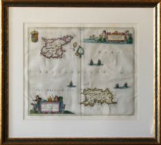

Joan Blaeu (1596-1673)
Map of Jersey and Guernsey, inscribed "Sarnia Insula, Vulgo Garnsey et Insula Caesarea, Vernacule Jarsey", hand coloured engraving on laid paper, ...
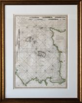
A Chart of the Islands of Jersey and Guernsey, Sark, Herm and Alderney; with the Adjacent Coast of France, dated 1781, with outline colouring, 20½...
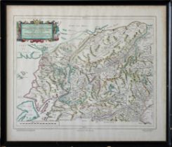
Reproduction map of the central Highlands of Scotland, 19¾ x 23¼ inches (50cm x 59cm)
after the 1787 original, framed and glazed, 54¼ x 48in. (137.8 x 122cm.).* Very good condition, good gilt frame.
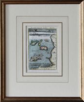
'Is. de Jersey et de Garnesey', copper engraved map, circa 1683, 6½ x 4½ inches (16.5cm x 11.5cm)
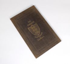
pub. 1884, printed at The 'Chronique' Office, St. Helier, Jersey, with five uncoloured engraved views and map, publisher's embossed blue cloth, gi...
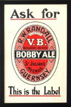
'Ask for R. W. RANDALL LIMITED V.B. VAUXLAURENS BREWERY -BOBBY ALE- St JULIAN'S AVENUE, GUERNSEY - This is the Label' black, red and white print, ...
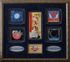
signed by five to central colour image, four inset CD's, well framed and mounted, 23 x 27in. (58.4 x 68.6cm.), comes with Certificate of Authentic...