Refine your search
Sale Section
Remove filter- Books & Maps (31)
Estimate
Category
Creator / Brand
Item Type
Remove filter- Map (31)
Filtered by:
- Sale Section,
- Item Type
- List
- Grid
A subscription to the Price Guide is required to view results for auctions ten days or older. Click here for more information
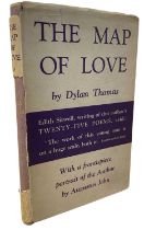

DYLAN THOMAS: THE MAP OF LOVE, London, J M Dent and Sons, 1939. First edition with original unclipped dustjacket. Some wear and fading, losses to ...
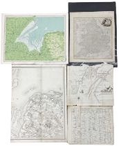
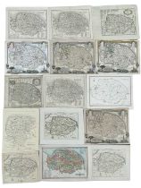
Five mixed maps, to include: J Bartholomew coloured engraved map, 'The Wash' from Survey Atlas 1903,
Five mixed maps, to include: J Bartholomew coloured engraved map, 'The Wash' from Survey Atlas 1903, Section XXII, Plate 33; Benjamin Baker half m...
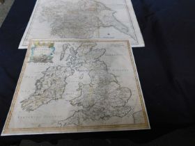
Pkt: Four assorted maps: 2 x Suffolk, Yorkshire, and Britannia Romana
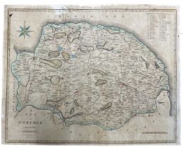
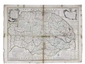
J CARY: Coloured engraved map 'A Map of Norfolk from the Best Authorities', c1805 Size approximately: 42x54cm;
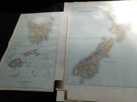
Pkt: Nine Stanford large folio maps, 1887, Australia, New Zealand and Pacific
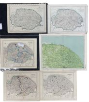
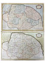
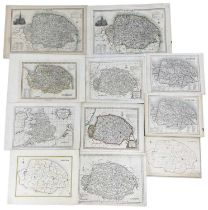
Six various coloured maps of Norfolk, to include: Walker's map of Norfolk, 1861, marked up for fox-
Six various coloured maps of Norfolk, to include: Walker's map of Norfolk, 1861, marked up for fox-hunting districts; Walker's map of Norfolk, 183...
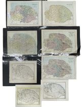
Eight various coloured maps of Norfolk, to include: Kelly's map of Norfolk, c1900; Weller's map of
Eight various coloured maps of Norfolk, to include: Kelly's map of Norfolk, c1900; Weller's map of Norfolk 1862; E Weller's map of Norfolk for Phi...
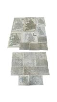
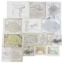
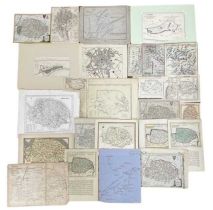
One packet: Various maps, mostly 19th century, British and European
EMAN BOWEN: Coloured engraved map of Norfolk divided into hundreds, 1749. Dedicated to 'The Right
EMAN BOWEN: Coloured engraved map of Norfolk divided into hundreds, 1749. Dedicated to 'The Right Honourable John, Earl of Buckingham, Lord Lieute...
ROBERT MORDEN: Two coloured maps of Norfolk. c1720s.Sizes approximately: 40x60cm
One packet: Mixed architectural plan and maps of Norfolk interest, to include: Hethersett, Wroxham, Carbrooke, Trunch etc
One packet of assorted 20th century maps, various sizes. mostly Mediterranean / North African
One packet of assorted 20th century maps, various sizes. mostly Mediterranean / North African interest
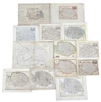
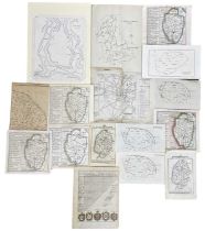
One packet: Assorted engraved maps and book plates of Norfolk, mostly 18th and 19th century.
One packet: Assorted engraved maps and book plates of Norfolk, mostly 18th and 19th century. Assorted sizes
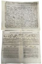
A pair of maps: GERMANY, folio size, woodcut: 16th century, Sebastian Munster, Cosmographia, View of
A pair of maps: GERMANY, folio size, woodcut: 16th century, Sebastian Munster, Cosmographia, View of Worms of Germany, German black letter to rect...
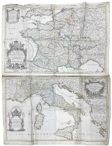
WILLIAM BERRY: A pair of 17th century engraved maps, to include: THE KINGDOM OF FRANCE DISTINGUISHED
WILLIAM BERRY: A pair of 17th century engraved maps, to include: THE KINGDOM OF FRANCE DISTINGUISHED ACCORDING TO THE EXTENT OF ALL ITS PROVINCES ...
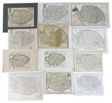
One packet: Assorted engraved maps and book plates of Norfolk, mostly 18th and 19th century.
One packet: Assorted engraved maps and book plates of Norfolk, mostly 18th and 19th century. Assorted sizes
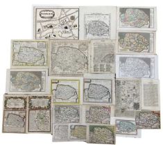
One packet: Assorted engraved maps and book plates of Norfolk, mostly 18th and 19th century. Various
One packet: Assorted engraved maps and book plates of Norfolk, mostly 18th and 19th century. Various sizes
One packet: Assorted engraved maps and book plates of Norfolk, 18th and 19th century, various
One packet: Assorted engraved maps and book plates of Norfolk, 18th and 19th century, various sizes.
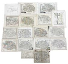
One packet: Assorted engraved maps and book plates of Norfolk, mostly 18th and 19th century.
One packet: Assorted engraved maps and book plates of Norfolk, mostly 18th and 19th century. Assorted sizes
One packet: Assorted engraved maps and book plates of Norfolk, mostly 18th and 19th century.
One packet: Assorted engraved maps and book plates of Norfolk, mostly 18th and 19th century. Assorted sizes
One packet: Assorted engraved maps and book plates of Norfolk, mostly 18th and 19th century.
One packet: Assorted engraved maps and book plates of Norfolk, mostly 18th and 19th century. Assorted sizes
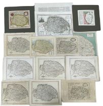
One packet: Assorted engraved maps and book plates of Norfolk, mostly 18th and 19th century.
One packet: Assorted engraved maps and book plates of Norfolk, mostly 18th and 19th century. Assorted sizes
One packet: Assorted engraved maps and book plates of Norfolk, mostly 18th and 19th century.
One packet: Assorted engraved maps and book plates of Norfolk, mostly 18th and 19th century. Assorted sizes
One packet: Assorted engraved maps and book plates of Norfolk, mostly 18th and 19th century.
One packet: Assorted engraved maps and book plates of Norfolk, mostly 18th and 19th century. Assorted sizes
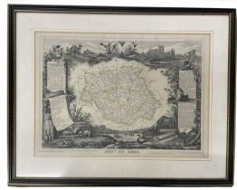
V LEVASSEUR: DEPT DU GERS, engraved map circa 1852, part hand coloured, approx 290 x 420mm, framed
V LEVASSEUR: DEPT DU GERS, engraved map circa 1852, part hand coloured, approx 290 x 420mm, framed and glazed
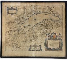
WILLEM JANSSON BLAEU (1571 - 1638): 17th century (c1635) engraved coloured map of Lake Geneva
WILLEM JANSSON BLAEU (1571 - 1638): 17th century (c1635) engraved coloured map of Lake Geneva after J Coulart from an early edition of Blaeu's ATL...
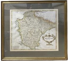
ROBERT MORDEN: DEVONSHIRE, engraved hand coloured map circa 1753, approx 358 x 470mm, framed and
ROBERT MORDEN: DEVONSHIRE, engraved hand coloured map circa 1753, approx 358 x 470mm, framed and glazed
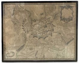
C B GLOT: Uncoloured 18th Century engraved map of Geneva (1777): 'Plan de la Ville de Geneve Corrige
C B GLOT: Uncoloured 18th Century engraved map of Geneva (1777): 'Plan de la Ville de Geneve Corrige sur les lieux, en 1777, et 93 Dedie aux Magni...
![RICHARD BLOME: A MAPP OF YE COUNTY OF ESSEX, engraved hand coloured map [1673], approx 255 x](https://portal-images.azureedge.net/auctions-2024/srkey11011/images/ee0b4d95-39c4-4f4c-978d-b16901312f1b.jpg?h=210)
RICHARD BLOME: A MAPP OF YE COUNTY OF ESSEX, engraved hand coloured map [1673], approx 255 x
RICHARD BLOME: A MAPP OF YE COUNTY OF ESSEX, engraved hand coloured map [1673], approx 255 x 320mm, framed and glazed
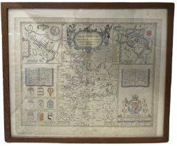
JOHN SPEED: Hand coloured and engraved map of Huntington, both Shire and Shire Towne with the
JOHN SPEED: Hand coloured and engraved map of Huntington, both Shire and Shire Towne with the Ancient Citie of Ely described, 1662Framed and glaze...
ONE BOX: Various 19th and 20th century folding maps