Refine your search
Filtered by:
- Sale Section
- List
- Grid
A subscription to the Price Guide is required to view results for auctions ten days or older. Click here for more information

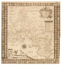
Bowles (Carington). Bowles's Pocket Atlas of the Counties of South Britain or England and Wales Drawn to one Scale....., London: circa 1785, doubl...
Camden (William). Britannia: or, a Chrographical Description of the Flourishing Kingdoms of England, Scotland, and Ireland, and the Islands Adjace...
Cary (John). Cary's New and Correct English Atlas: being a New Set of County Maps from Actual Surveys..., London: Jany 1st, 1793, 47 (complete as ...
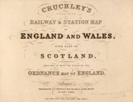
Cruchley (G. K. publisher). Cruchley's Complete Railway & Station Map of England and Wales, with Part of Scotland, This Map is Half the Scale of t...
Edwards (J.). A Companion from London to Brighthelmston in Sussex; Consisting of a set of Topographical Maps from Actual Surveys..., printed by T....

Fletcher (John). A Dreadful Phenomenon described and improved: being a particular account of the sudden stoppage of the River Severn, and of the t...
Grose (Francis). A New and Complete Abridgment or Selection of the Most Interesting and Important Subjects in The Antiquities of England and Wales...
Lambard (William). A Perambulation of Kent: Conteining the description, Hystorie, and Customes of that Shyre. Collected and Written (for the most ...

Lee (John). Isca Silurum or an Illustrated Catalogue of the Museum of Antiquities at Caerleon, 1862
Lee (John Edward). Isca Silurum or an Illustrated Catalogue of the Museum of Antiquities at Caerleon, London: Longmans Green Longmans & Roberts, 1...
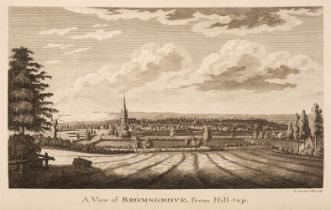
Nash (Treadway Russell). Collections for the history of Worcestershire, 2 volumes, 1st edition, London: Printed by John Nichols, 1781-82, titles w...
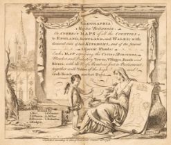
Osborne (Thomas). Geographia Magnae Britanniae. Or, Correct Maps of all the Counties in England, Scotland and Wales; with General ones of both Kin...

Pennant (Thomas). A Tour in Wales, 2 volumes, 2nd edition, London: Benjamin White, 1784, 49 engraved plates (of 53, however with 10 supplemental p...
Plot (Robert). The Natural History of Oxford-shire, Being an Essay Toward the Natural History of England..., 2nd edition, Oxford: Leon Lichfield f...
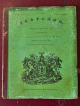
Scottish Topography. Brown (William, illustrator). Select Views of the Royal Palaces of Scotland..., Edinburgh: Cadell & Co et al., 1830, 21 uncol...
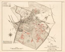
Small-Pox Vaccination Maps. Gloucester and Warrington, London: Her Majesty's Stationery Office,
Small-Pox Vaccination Maps. Appendix VII to the Final Report of the Royal Commission on Vaccination. Report to the Commission of Dr. Sidney Coupla...
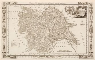
Tunnicliffe (William). A Topographical Survey of the Counties of Hants, Wilts, Dorset..., 1791
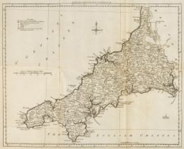
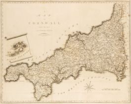
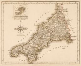
Tunnicliffe (William). A Topographical Survey of the Counties of Hants, Wilts, Dorset, Somerset, Devon and Cornwall, Commonly called the Western C...
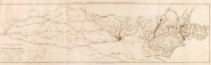
Wales. Reports from Committees on Holyhead Roads, Harbours &c in the Years 1810, 1811, 1815, 1816, 1817, 1819, 1820 and 1822 [communicated by the ...
Walpoole (George Augustus). The New British Traveller; or, a Complete Modern Universal Display of Great Britain and Ireland: being a new, complete...
![[Wood, Anthony]. Historia Universitatis Oxoniensis, 1674 & other topography](https://portal-images.azureedge.net/auctions-2024/srdom10237/images/74ef7a4f-aa42-49da-a518-b16200a8a5da.jpg?h=210)
[Wood, Anthony]. Historia et Antiquitates Universitatis Oxoniensis, 1st edition, Oxford: Sheldonian Theatre, 1674, additional engraved title, titl...